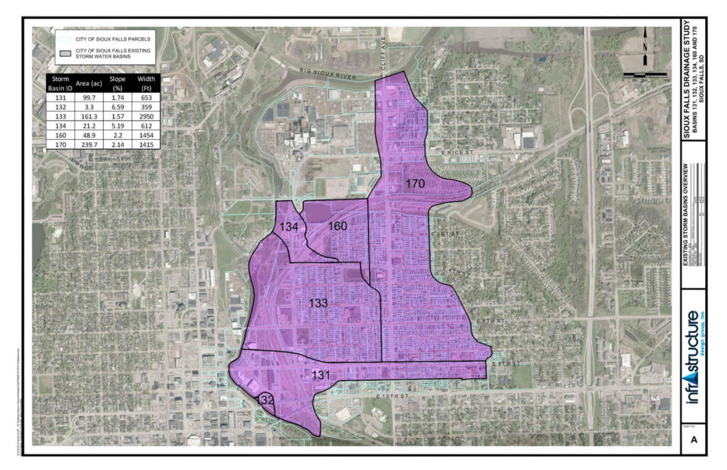
InfrastructureDG completed two separate drainage studies for the City of Sioux Falls. The first study focused on five different drainage basins that extended south from the Big Sioux River along Cliff Avenue, south to East 10th Steet and west to the Big Sioux River. The second study focused on a single basin in northern Sioux Falls that extended south from East 60th Street along Cliff Avenue to East 31st Street and east from the Big Sioux River along Benson Road to North Lewis Avenue. Infrastructure DG conducted surveys throughout the basins to gather existing storm sewer information and topography to be used in combination with the City’s LiDAR information to perform 1D and 2D XPSWMM models.
The 2D XPSWMM models were key in identifying areas that were not compliant with the current City’s Design Standards. XPSWMM utilizes topography and a “rain-on-grid” method for modeling storm events over large areas and computes the flow, velocity, and ponding throughout the basin. The studies recommended proposed improvements for areas found to be not in compliance with current standards.